Crossroads
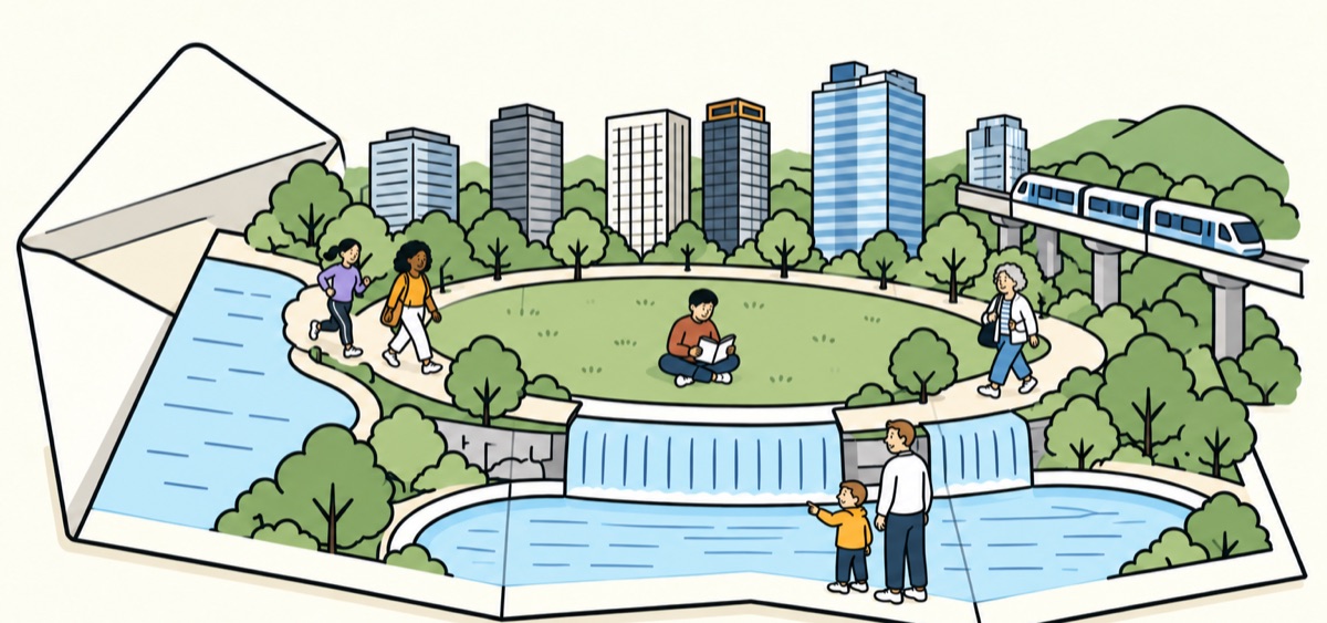
A shopping-center gathering place, a park next door, and homes tucked into the large blocks between east Bellevue's main roads.
Logging gave way to farming here, then to postwar subdivisions and shopping. Crossroads Shopping Center opened in stages and was fully open in 1964; later growth added apartments and offices around it. Today the mall and neighboring park anchor a neighborhood whose large blocks can make a short trip on the map a longer trip on foot.
- Homes
- Median sale: condos $510,000, houses $1.79 million
- Schools
- Stevenson · Highland or Odle · Interlake or Sammamish
- Getting around
- RapidRide B follows NE 8th Street and 156th Avenue NE; nearby rail stations sit beyond the neighborhood.
Living here
Where to go
- 15600 NE 8th Street
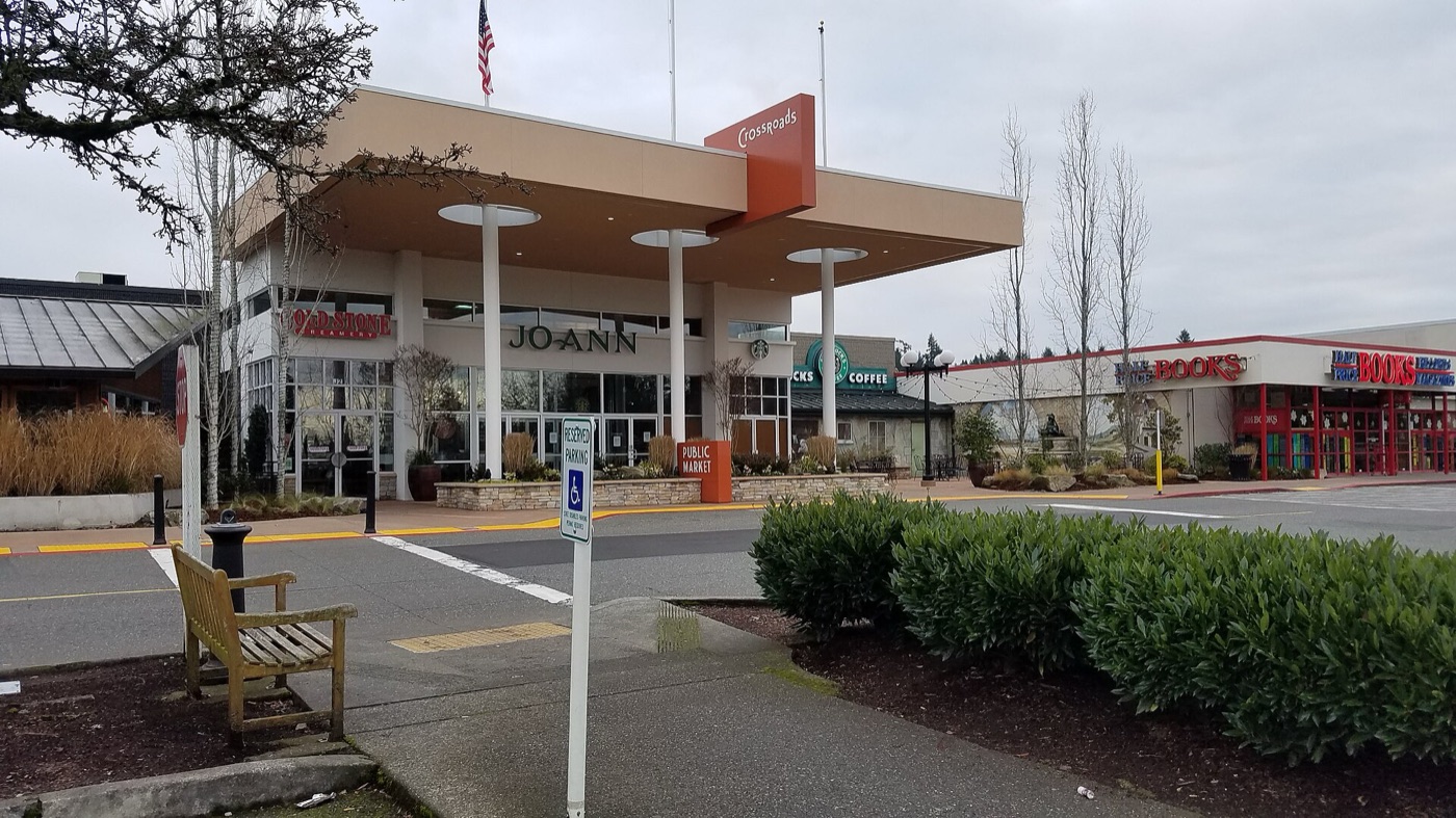
Crossroads Shopping Center
A food court, shops and a live-music stage under one roof. The directory, read 26 October 2026, lists Nan Hotpot, Mr. Huang Claypot Chicken Express, JINYA and Boba Express; check it before going, as the entrance photo shows older signs.
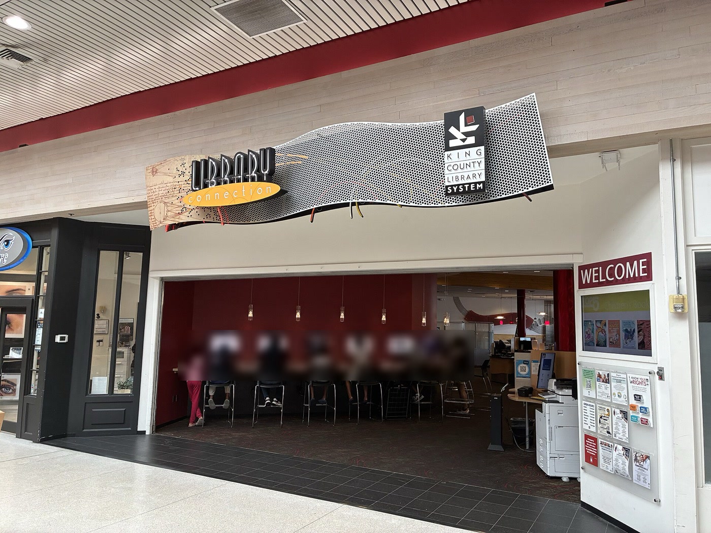 15600 NE 8th Street, Suite K-11
Library Connection at Crossroads
A small library inside the mall with books, computers, printing and Wi-Fi. KCLS lists its collection as smaller than a full-service branch.
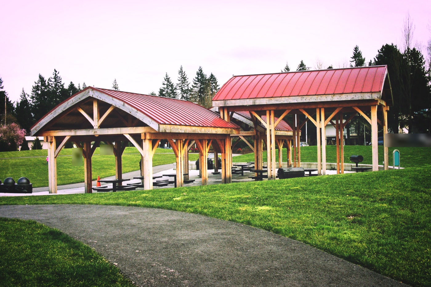 999 164th Avenue NE
Crossroads Park
Paths, courts and picnic shelters beside the shopping center. The spray playground can be used without its seasonal water; this shelter photograph is from 2006.
Where people live
Detached houses sit on looping streets and cul-de-sacs, while apartments, condominiums and townhomes occupy larger sites along the main roads. Multifamily clusters lie northwest of NE 8th Street and 140th Avenue NE, around the shopping center, and between 152nd and 156th avenues NE. Smaller townhome clusters also run along the south side of NE 8th Street. The aerials show residential patterns in 2023; parcel-layer zone labels describe how the views were selected, rather than today's development rights.
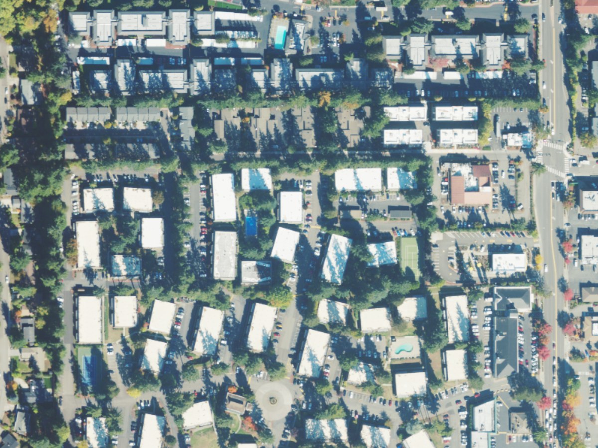
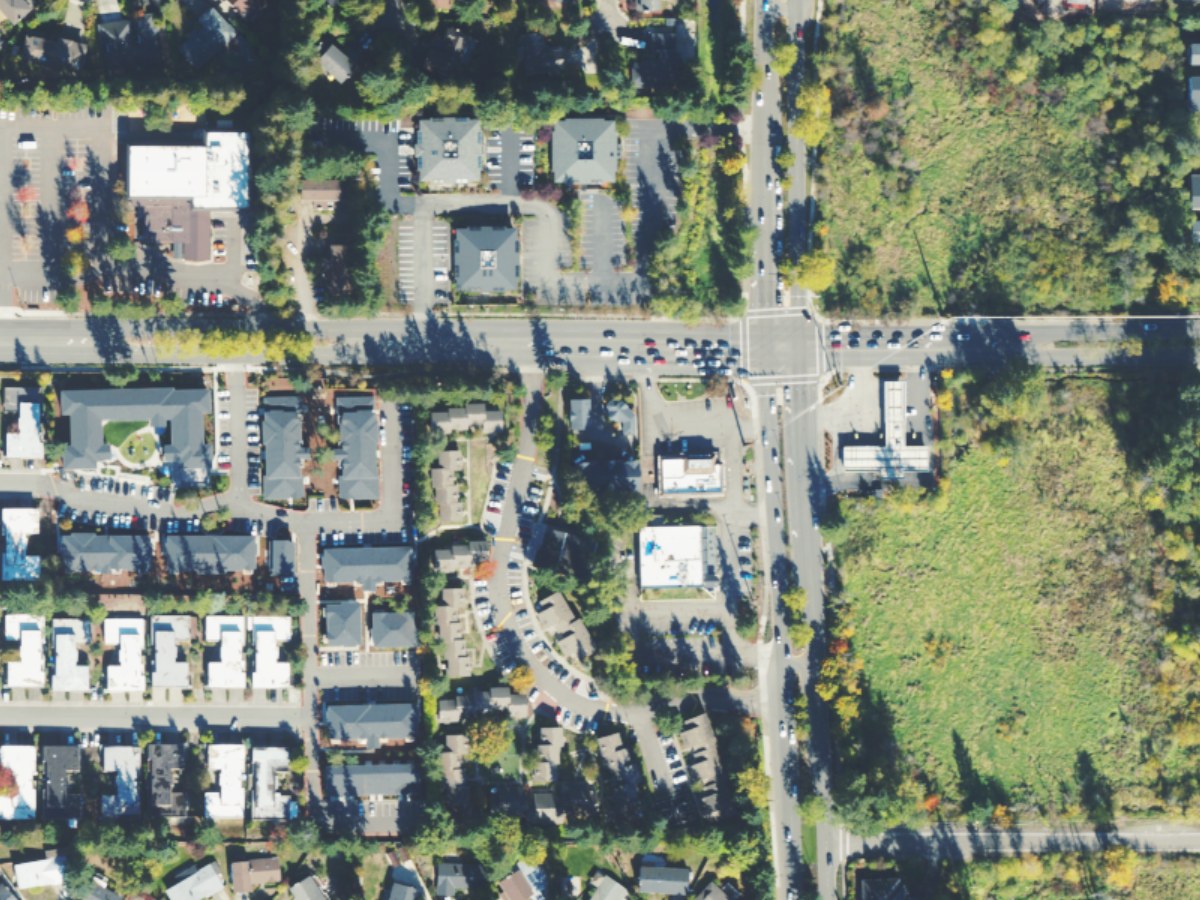
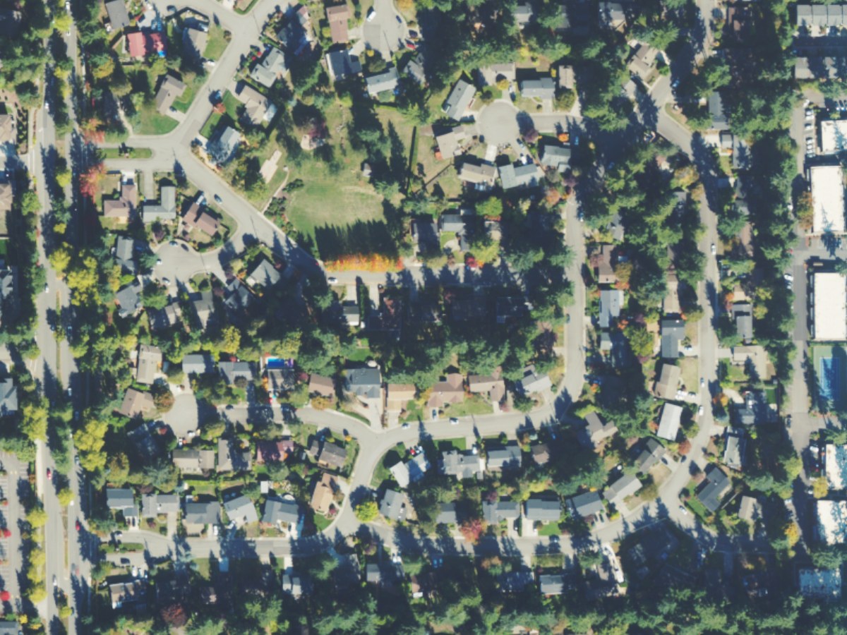
What homes here sold for in the year to 14 October 2026, from the sales King County records.
Houses and townhouses$1.79 million median 18 sales · Bellevue $1.89 million
Condos$510,000 median 31 sales · Bellevue $615,000
A median describes the homes that happened to sell, not every home here. Only ordinary sales count: estate, family, foreclosure and multi-parcel sales are left out. A type with fewer than 10 sales shows no median. Rents are not public record.
Schools that serve it
Bellevue School District assigns schools by address. Each bar is the share of the 997 addresses here that a school serves.
- Stevenson99%about 560 students
- Highland80%about 530 students
- Odle20%about 990 students
- Interlake80%about 1,690 students
- Sammamish20%about 1,280 students
From the attendance areas the City of Bellevue maps for the district, read 25 August 2026. Boundaries change and an address near a line can differ: confirm with the district’s school locator. Choice and application schools have no attendance area and are not listed. Enrollment is each whole school’s, all grades, from the OSPI Report Card for 2025-26 (data as of 1 June 2026), rounded to the nearest ten; it counts every student, not only those from here.
Getting around
More about this map
Geometry simplified to about 12 metres. Station point is the platform centre. The frame is the area plus a few hundred metres; only routes with a stop in the area or at its edge are drawn, each direction, variant and carriageway as one line; routes within 60 metres of each other share a road and are drawn side by side.
- Metro GTFS: 20260928 to 20270326 (FAL26-161.2); retrieved 2026-10-27.
- Sound Transit GTFS: 20261001 to 20270326 (SC-Fall-2026.5); retrieved 2026-10-27.
- OpenStreetMap snapshot: 2026-10-24T20:20:51Z; retrieved 2026-10-27.
- By bus, RapidRide B connects Crossroads with downtown Bellevue and Redmond via Overlake. Routes 223 and 245 also serve the shopping-center corridor; use Metro's current schedules rather than the older bus network in the city's Existing Conditions report.
- For rail, Overlake Village Station on the 2 Line is north of the shopping-center end of Crossroads, in Redmond. Route 223 provides a bus connection. BelRed Station is another option near the neighborhood's northwest side; a station being nearby does not establish a short walk from every home.
- On foot or by bike, Crossroads Trail connects the park toward Northup Way. The map shows the regional SR 520 Trail near Overlake Village Station, reached by the station pedestrian bridge; it does not show an uninterrupted trail from the mall. Arterials divide large residential blocks, and internal paths do not always continue through to the next street; check the actual entrance and crossing before choosing a route.
- Driving, NE 8th Street, Northup Way, Bel-Red Road and the north-south avenues carry trips between the smaller residential street systems. The shopping center is reached from NE 8th Street and 156th Avenue NE.
What’s changing
The city’s plan for Crossroads
Crossroads' neighborhood area plan was adopted on 21 October 2025. These cards pair the city's recorded conditions with what its adopted policies call for; the template's ‘The plan would’ label describes policy intent, not a pending adoption. Neither a policy nor a concept map is a funded construction commitment. No further Crossroads area-plan decision date is listed on the city's current Great Neighborhoods schedule. Separately, the high-density residential code project proposes rezones around Crossroads; its page does not yet give a hearing or adoption date.
The shopping center as a gathering place
NowThe mall combines shops, food and community services; the plan identifies it as a gathering place where people can meet without buying something.
The plan wouldWork with private partners to sustain that gathering role and make more accessible, affordable indoor meeting places available elsewhere in Crossroads (S-CX-20, S-CX-21).
Space for small businesses
NowSmall shopping centers at arterial intersections sit alongside the larger mall district.
The plan wouldHelp retain small businesses through affordable commercial space, and support permanent and temporary places for emerging food businesses and vendors (S-CX-9, S-CX-10).
Housing and the neighborhood centers
NowThe city describes both detached-house neighborhoods and apartment, condominium and townhome clusters, with shops concentrated near key intersections.
The plan wouldMaintain existing affordable housing, support a compact mixed-use center, and mix homes, retail and services in neighborhood centers (S-CX-11, S-CX-14, S-CX-17).
Parks beyond the eastern hub
NowCrossroads Park provides a major gathering place at the eastern end; the plan identifies a need for more neighborhood parks farther west.
The plan wouldAcquire suitable park parcels, especially west of 152nd Avenue NE, and improve the pedestrian connection between Crossroads Park and the surrounding homes and businesses (S-CX-6, S-CX-19).
Through the blocks and across the arterials
NowLarge blocks and limited internal street connections put many walking trips alongside busy roads; rail stations are outside the neighborhood.
The plan wouldImprove walking and bicycle links to frequent buses and nearby rail, make arterial crossings safer and obtain pedestrian connections through superblocks (S-CX-25, S-CX-26, S-CX-27, S-CX-28).
Trees, creek access and heat
NowThe plan identifies Kelsey Creek and natural areas as assets alongside commercial areas with opportunities for more shade.
The plan wouldImprove access to the Kelsey Creek Basin, expand tree canopy and adapt public spaces for extreme heat and rainfall (S-CX-32, S-CX-33, S-CX-34).
Code changes after the area plan
NowThe Council approved HOMA in March 2026. A separate high-density residential and planned-unit-development code project, launched in May, proposes rezones around Crossroads and Factoria.
The plan wouldSupport a compact mixed-use center with more housing options (S-CX-14). The separate code process would implement the Comprehensive Plan map; its current project page lists no hearing or adoption date.
These are policies the Council adopted, not funded projects: none comes with a budget or a date unless its card states one.
Where it stands
The Council resumed Great Neighborhoods with Crossroads and Newport.
The Planning Commission received its initial briefing on Crossroads and Newport planning.
The city issued the notice of application for the Crossroads neighborhood area plan update.
The Planning Commission received an update on the Crossroads and Newport neighborhood planning work.
The Council received the neighborhood planning update for Crossroads and Newport.
The Parks and Community Services Board reviewed the neighborhood planning update.
The Arts Commission received an update on Crossroads and Newport planning.
The Planning Commission reviewed the full Crossroads draft and scheduled the public hearing.
The Planning Commission held Crossroads' final-review public hearing and recommended adoption to the Council.
The Council reviewed the Commission's recommended Crossroads and Newport neighborhood plans.
The Council adopted Crossroads' neighborhood area plan; implementation depends on later project, budget and code decisions.
The Council approved Housing Opportunities in Mixed-Use Areas code amendments, a separate code action from the Crossroads area plan.
The Council initiated the high-density residential and planned-unit-development code project, including proposed rezones around Crossroads. A later hearing or adoption day is not listed on its project page.
The Planning Commission agenda included a study session on the separate high-density residential and planned-unit-development code amendment.
What’s coming
No opening with a confirmed date is listed here yet.
How this was checked
Boundary: the City of Bellevue’s Neighborhood Areas layer, the Comprehensive Plan’s planning areas. Place information was checked against the sources and dates under Sources.
Schools: every addressed parcel the city publishes, placed in the district’s attendance areas and, outside them, in the city’s school-district layer. A school serving under 5% of an area’s addresses is left out. Enrollment: OSPI’s Report Card enrollment on data.wa.gov, the all-students count for each school, read by scripts/neighborhood_enrollment.py.
Home prices: the King County Assessor’s Real Property Sales extract, ordinary sales of houses and condos by warranty deed with no non-market flag, placed by parcel number in the city’s parcel layer (a condo by its building).
Sources (7)
Sources
- History, homes, large blocks and policy references: Bellevue's adopted Crossroads Neighborhood Area Plan, S-CX-2, 4–5 and 12–14; Existing Conditions report, pages 7–8, 11–16 and 26–28. Read 26 October 2026. Conditions describe the report's baseline, not a new field survey.
- Decision history and current planning schedule: Great Neighborhoods, its archived meeting overview, and the city's adoption announcement, read 26 October 2026. The November review of Eastgate and Factoria is a different planning round.
- Current destinations: the operator's Crossroads store directory, KCLS Crossroads branch, and the city's Crossroads Park page, read 26 October 2026. Licensed photographs date from 2006, 2018 and 2025; the photographs do not establish current tenants or facilities.
- Travel: Metro's RapidRide B timetable, 223, 245, and East Link Connections; Sound Transit's Overlake Village Station. Read 26 October 2026. The saved map joins the agencies' active GTFS trips to their shapes and stops; it does not estimate journey times.
- Separate implementation work: Housing Opportunities in Mixed-Use Areas, approved 17 March 2026, and High-Density Residential / Planned Unit Development code amendment, initiated 12 May 2026. Read 26 October 2026. The 10 June study-session agenda records the next early review. Proposed rezones are distinct from an approved project or construction start.
- Station-side trail connection: Sound Transit, Eastside pedestrian bridges, read 26 October 2026. The SR 520 Trail is north of Crossroads, across the station bridge, rather than a path through the shopping center.
- Residential views: public-domain USDA NAIP imagery acquired 7 October 2023, retrieved through Microsoft Planetary Computer on 26 October 2026. Views center on actual residential parcels nearest each selected zone's median centroid inside the city area; selection, source links and image hashes are retained in the research record.
Photo credits
- Crossroads Shopping Center's west entrance, December 2018: Mark Yasuda, 2018, CC BY-SA 4.0, via Wikimedia Commons.
- Red-roofed picnic shelters beside lawn and paved paths in a historical park…: Steven Pavlov, 2006, CC BY-SA 4.0, via Wikimedia Commons, modified.